Travel to the National Treatment Centre - Highland

On this page

Transport and directions to the National Treatment Centre - Highland, in Inverness, and parking.

National Treatment Centre - Highland
Inverness Campus
Inverness
IV2 5NA

The NTC is situated on the eastern side of Inverness, on the opposite side of the main A9 road to Raigmore Hospital.

See more information on travel within the NHS Highland area.
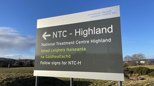
National Treatment Centre Highland Sign

Map of area

Travelling by car

A 20mph speed limit is in place across the campus and priority should be given to pedestrians, cyclists, and other non-car users. As you leave the campus at the traffic lights, please note that the middle lane is a bus lane.

Directions for driving

Heading north on the A9 towards Inverness

  • pass the exit to Milton of Leys and take the next exit off the A9 signposted Raigmore Hospital
  • at the roundabout ahead, take the first exit signposted Culloden Moor and Croy
  • cross the flyover above the A9, keeping to the left-hand lane
  • at the next set of traffic lights turn left, signposted Inverness Campus
  • at the next roundabout, take the first exit
  • follow the road to the crossroads then turn left
  • turn left to reach the National Treatment Centre

Heading south on the A9 passing Inverness

  • at the roundabout by the Kessock Bridge and football stadium, take the exit signposted Aberdeen and Perth to stay on the A9 southbound
  • pass the exit signposted Aberdeen A96
  • take the next exit signposted Culloden, Croy and Raigmore Hospital
  • keep in the right lane
  • at the traffic lights at the top of the rise, head straight across the junction to Inverness Campus
  • at the next roundabout, take the first exit
  • follow the road to the crossroads then turn left
  • turn left to reach the National Treatment Centre

From Inverness city centre

  • head east along the main Academy Street
  • passing the Eastgate shopping centre and Morrisons supermarket, continue along Millburn Road
  • at the roundabout by the railway level crossing, take the second exit (straight ahead) signposted Perth (A9)
  • approaching the next, larger roundabout, take the right hand lane marked Perth A9 S
  • take the third exit, signposted Perth A9
  • keep in the left lane when merging with the A9
  • take the next exit signposted Culloden, Croy and Raigmore Hospital
  • keep in the right lane
  • at the traffic lights at the top of the rise, head straight across the junction to Inverness Campus
  • at the next roundabout, take the first exit
  • follow the road to the crossroads then turn left
  • turn left to reach the National Treatment Centre

From the A96 from Moray or Aberdeen

  • at the roundabout at the retail park approaching Inverness, take the second exit (straight ahead) to stay on the A96
  • at the next roundabout, take the first exit, signposted Perth A9
  • keep in the left lane when merging with the A9
  • take the next exit signposted Culloden, Croy and Raigmore Hospital
  • keep in the right lane
  • at the traffic lights at the top of the rise, head straight across the junction to Inverness Campus
  • at the next roundabout, take the first exit
  • follow the road to the crossroads then turn left
  • turn left to reach the National Treatment Centre

From the A82 from Fort William or Oban

  • at the roundabout at Torvean golf course, take the third exit to cross the Caledonian Canal at the swing bridge
  • take the second exit to turn right at the roundabout
  • stay on this distributor road which skirts around Inverness, following the signs for Raigmore Hospital and Perth
  • approaching the final roundabout, signposted to Police HQ, Raigmore Hospital and Inshes Retail Park, keep in the right lane
  • take the fourth exit, signposted all other routes, A9(S), B9006 Culloden Moor, Croy and Perth (A9)
  • cross the flyover above the A9, keeping to the left-hand lane
  • at the next set of traffic lights turn left, signposted Inverness Campus
  • at the next roundabout, take the first exit
  • follow the road to the crossroads then turn left
  • turn left to reach the National Treatment Centre

From the B9177 from Culloden, Cradlehall and Westhill

  • come downhill on Culloden Road, passing Simpsons Garden Centre on the left
  • continue to the next junction and take the right lane, signposted to Cradlehall Business Park
  • take this right turn on to Caulfield Road North (if you miss this turn, there is no right turn at the next, larger junction)
  • take the next left signposted Inverness Campus
  • at the next roundabout, take the second exit (straight on)
  • follow the road to the crossroads then turn left
  • turn left to reach the National Treatment Centre

Parking

Patient vehicle access and limited parking is located at the front of the NTC building. There are 12 spaces available for blue badge holders.

There is a vehicle turning circle at the front entrance, for drop-off only. Wheelchairs are available inside the main entrance on the right.

If you are dropping someone off for a longer appointment and where mobility allows, please use one of the visitor car parks on the Inverness Campus instead - you may want to take the opportunity to explore the campus.

Travelling by bus

The National Treatment Centre is easily accessed by public bus transport, on several routes. 

To confirm services, see Stagecoach service timetables and routes. Download the Stagecoach mobile app for routes and real-time service updates. You may wish to check with the provider of a bus service on the day of travel, for service updates or route changes.

When searching bus timetables, the location is Inverness UHI Campus. The Campus has four bus stops which feature real time information displays. Bus stop number 3 at the NTC is the stop you should use, situated right outside the Inverness UHI campus Residencies Quarters.

See more information about public transport within the NHS Highland area.

Services

Buses travelling to and from Inverness Campus include:

  • 2, 3, 5/5A/5C, 6/6A/6C
  • Black Isle and Easter Ross: X25, 26, 27 and X28
  • Nairn: 11, 27 - changing at Inverness Airport terminal building or the airport railway station
  • Badenoch and Strathspey: M39

From Inverness city centre

Buses from the city centre leave from Falcon Square, between Marks and Spencer and the Eastgate shopping centre.  This is a few minutes' walk from the railway station and bus station. There is also a bus stop at Queensgate, next to the main Post Office in the city centre.

Map of nearby bus stops

Find nearby stops on this interactive map. Selecting a bus stop will provide information on the services that use that stop, and the walking distance to the entrance of NTC Highland.

Travelling by taxi

There is a taxi rank in Inverness city centre on Academy Street by the rail station. Inverness Campus is approximately a 10-minute journey from the city centre.

Walking and cycling

The campus is approximately a 30 minute walk from Inverness city centre (3km) and is designed for easy access on foot.

A pedestrian bridge crossing the A9 links the campus with UHI House, Raigmore Hospital, Lifescan Scotland and on to Inverness city.  To the east, linking to Inverness Business and Retail Park, there are two pedestrian bridges for safe travel across the railway.

Inverness has public electric bikes - see details at hi-bike.co.uk. There is a virtual station at Inverness Campus where you can terminate your trip. They are easy to ride and cheap to hire. Collect a bike from the charging stations at:

  • Eden Court
  • Great Glen House (Leachkin)
  • Inverness Campus
  • Inverness Leisure
  • Inverness rail station
  • Raigmore Hospital

See more information on active travel to plan your route on foot or by bike, including an active travel map of Inverness.
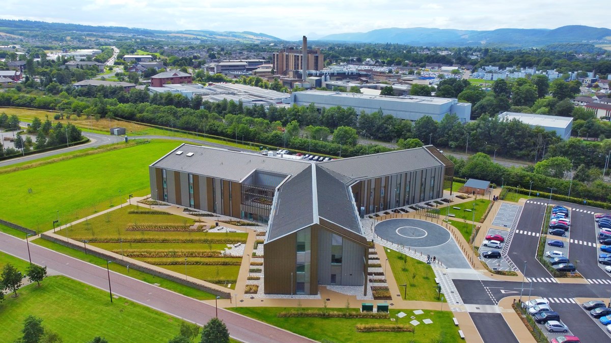
National Treatment Centre Highland with Raigmore Hospital and Inverness in background

Last updated: 26 November 2024